November 14, 2023
Image shows a helicopter in flight towing a large hexagonally shaped device with mountains in the background
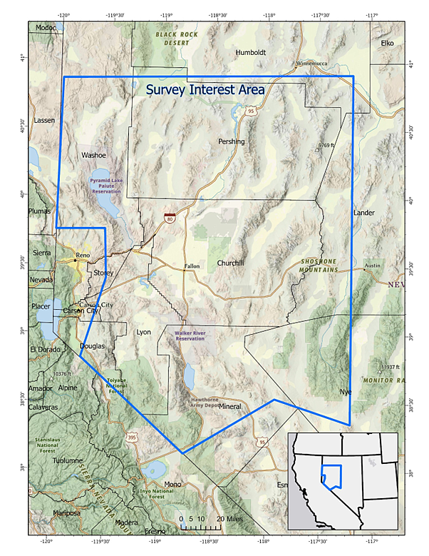
RESTON, Va. — Low-level helicopter flights are planned over a broad region in western Nevada to image geology using airborne geophysical technology. The survey will begin in Nov 2023 and is to be completed by April 2024, weather, wildlife and wildfire restrictions permitting. Flights will cover an area of more than 15,000 square miles (39,000 square kilometers) and will include areas Churchill, Douglas, Humboldt, Lander, Lyon, Mineral, Nye, Pershing, Storey, Washoe and Carson City County in Nevada.
Comments
Use the comment form below to begin a discussion about this content.
Sign in to comment